Journals
Publication Years
Channels
 
Article type
Not found

      自然灾害,如地震、火山喷发、滑坡、泥石流、海啸、风暴、洪水及其灾害链等,在地质时间尺度上均表现为瞬变事件,遗留下不同类型的沉积记录。通过解析这些保存于陆地和海洋环境中的事件沉积,可以获取灾害事件的发生时间、规模、强度和历史等关键信息,有助于理解其发生过程、发育机理和演化规律。这不仅有助于加深对地球系统突变过程的认识,还可以为防灾、减灾提供科学支撑。

      为了及时地展示国内外“事件沉积学”方向的科研进展及与其相关的最新动向(如国际大洋钻探未来科学计划等相关内容),为地学领域的研究提供多元化知识服务,《地球科学进展》于2023年4月特开设“事件沉积与灾害历史”专栏,特邀刘维明研究员(中国科学院、水利部成都山地灾害与环境研究所)和卢银教授(同济大学海洋地质国家重点实验室)共同担任专栏主编,至今已经刊发一系列稿件,供专家学者借鉴。

      热忱欢迎“事件沉积学”相关方向的专家学者继续踊跃供稿!

Please wait a minute...
  • Select all
    |
  • Shiqing LIANG, Chuanxiu LUO, Rong XIANG, Islam ARIFUL, Haicheng WEI, Xiang SU, Sui WAN, Shuhuan DU, Lanlan ZHANG, Yiping YANG, Yun HUANG, Gang LIN
    Advances in Earth Science. 2024, 39(6): 616-631. https://doi.org/10.11867/j.issn.1001-8166.2024.048

    The occurrence of fire events is closely related to climate change and vegetation changes. A systematic study of the spatial and temporal evolutionary patterns of Holocene fire activities enables a clearer comprehension of the association between fire activity mechanisms and regional climate and vegetation changes, and contributes to the prediction of future fire evolutionary trends simultaneously. In order to comprehend the fire evolution and potential driving factors in the surrounding areas of the Andaman Sea, charcoal analysis was conducted on core ADM-C1 in the southern Andaman Sea to reconstruct its Holocene fire record. Additionally, five other charcoal records were synthesized to reconstruct Holocene fire activities in the surrounding areas of the Andaman Sea in this study. Although the nature of the changes of ignition, fire weather, and vegetation composition varied from place to place, leading to regional and local variations in fire frequency, the changes of fire event frequency around the Andaman Sea were widely synchronized under broader climate change during the Holocene. The frequency of fire activity around the Andaman Sea during the Holocene was influenced by regional variations in vegetation and precipitation, and ultimately by changes in the intensity of the Indian Summer Monsoon. Compared to the last deglaciation, there was a decrease in the frequency of fire activities in the surrounding areas of the Andaman Sea during 12.0~9.0 ka BP period, reflecting a gradual increase in Indian Summer Monsoon precipitation and woody plant abundance within this region. During 9.0~5.0 ka BP period, regional fire activity was constrained by higher Indian summer monsoon precipitation and woody plants. After 5.0 ka BP, an increase in regional fire activity primarily reflected a decrease in Indian Summer Monsoon precipitation. Furthermore, the changes in El Ni?o-Southern Oscillation (ENSO) intensity, Indian Ocean Dipole (IOD) phase and the location of the Intertropical Convergence Zone (ITCZ) were related to fire activity frequency around Andaman Sea during the Holocene.

  • Kaixi JIANG, Ming SU, Chunming LIN, Jiawei LIU, Yaping LEI, Ce WANG, Hui CHEN, Wenbin MA
    Advances in Earth Science. 2024, 39(3): 279-291. https://doi.org/10.11867/j.issn.1001-8166.2024.024

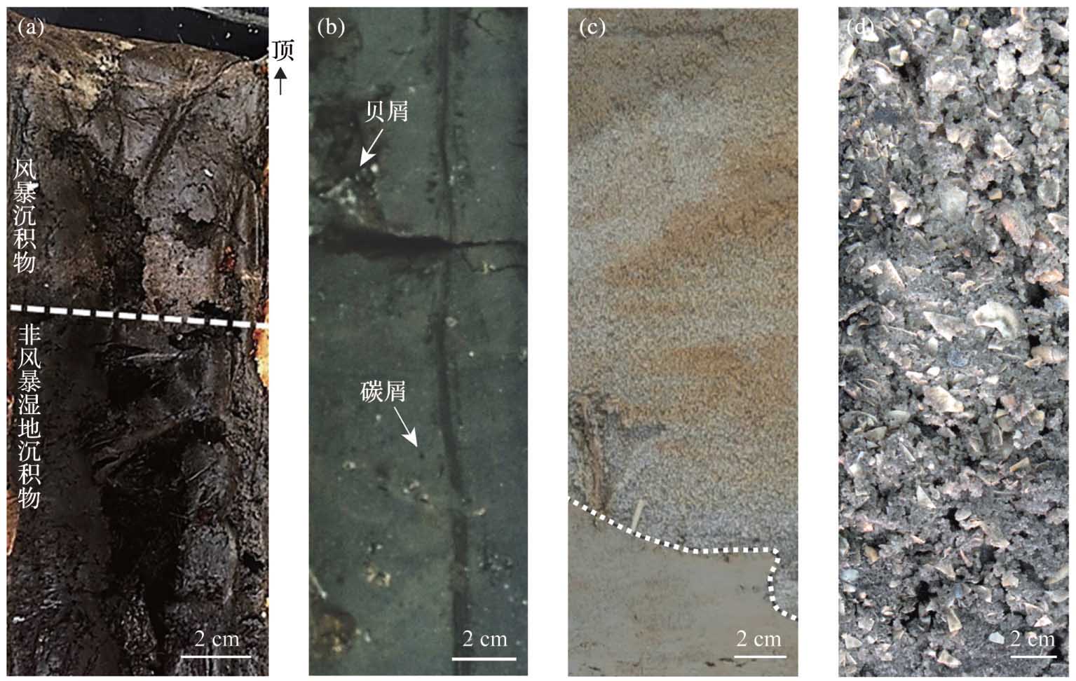
    Storm deposits ranging from the Precambrian era to the present day are found extensively in stratigraphic layers spanning almost all ages. These deposits serve as good records preserving information on paleo-extreme weather events that transpired throughout this extensive timeframe. Research on palaeostorm deposits is crucial for supplying vital long-term information for forecasting the evolutionary trends of future extreme weather events. The precise recognition of storm deposits is the pivotal foundation of this research. In previous research, the primary emphasis has been placed on easily discernible sandy storm deposits, carbonate (calcareous) storm deposits, storm pebbles, cobbles, and shell beds associated with storms because of their relative ease of identification. However, there has been a notable absence of investigations on muddy storm deposits, which presents challenges for identification. In recent years, significant progress has been made by researchers in refining the methods and indicators for identifying coastal muddy storm deposits, understanding depositional processes, and reconstructing paleostorm history. These advancements have played a crucial role in enhancing our comprehension of storm sediment classifications and in reconstructing the detailed history of paleostorm activity at high resolution. This study focuses on reviewing the recent advances in identification indices for coastal muddy storm deposits. We found that the integrated use of elemental, isotopic, and organic geochemistry serves as a sensitive indicator critical for the identification of muddy storm deposits. However, further research is required on the response mechanisms between the geochemical identification indicators of muddy storm sediments and the dynamics of storm deposition processes. It is emphasized that systematic comparative studies of muddy storm sedimentation in different sedimentary environments, field in situ observations, and laboratory simulations, as well as the strengthening of interdisciplinary collaboration, are worthy of priority as research focuses and directions for the future.

  • Jidong ZHANG, Chao LIANG, Yingchang CAO, Ao CHEN, Yin LU
    Advances in Earth Science. 2024, 39(1): 96-107. https://doi.org/10.11867/j.issn.1001-8166.2024.007

    Identification of trigger(s) and understanding of formation mechanism(s) and process(es) are the primary focus of event sedimentology studies. The triggering of soft-sediment deformation is usually attributed to earthquake shaking, despite the lack of solid evidence to support seismic-forced deformation mechanisms and sedimentary processes, e.g., previous study cases from the Dengta outcrop, Linshan Island, Qingdao, and East China. However, soft-sediment deformation can be triggered by either earthquakes, storms, non-earthquake events involving liquefaction, gravitational loading, or slumping. In addition, the deformation can be controlled by either the Rayleigh-Taylor instability or the Kelvin-Helmholtz instability. Therefore, features of the deformation structure alone cannot be used as indicators for trigger identification. A new approach for trigger identification that involves analyzing the combined features of two event layers has been successfully applied in the Dead Sea Basin (Dead Sea Fault) in the Middle East. In this study, we apply this novel approach to analyze the deformation mechanism and trigger of a large-scale soft-deformed layer in the Dengta outcrop, Lingshan Island, Qingdao. We observe that large-scale soft-sediment deformation is in situ formed and preserved; a turbidite layer overlies the in situ deformed layer; and no background sediments have accumulated between the two event layers. These features indicate that in situ and ex situ sedimentary responses occurred simultaneously. Strong regional seismic shaking is the most plausible trigger for the contemporaneous occurrence of in situ and ex situ sedimentary responses when considering regional geological settings.

  • Lu ZHANG, Wei WANG, Guodong JIA, Kai YI, Zhenqing ZHANG
    Advances in Earth Science. 2023, 38(11): 1173-1185. https://doi.org/10.11867/j.issn.1001-8166.2023.067

    To reveal the long-term evolution of fire in the Xiaoxing’an Mountains, the historical fire records for the past 1100 years were reconstructed at the local, neighboring, and regional scale based on the analysis of large (>125 μm), medium (50~125 μm) and small (<50 μm) charcoal found in a representative peat core. Based on this, in combination with data on the existing climate, vegetation, and human activities in the study area, the mechanism of response to environmental changes is discussed. Our findings indicate that relatively warm and dry climatic conditions were conducive to fire occurrence. Fire frequencies and intensities were controlled by herbaceous and woody plants, respectively. Affected by such environmental conditions, the local, neighboring, and regional fire regimes during 1 100~900 Cal a BP exhibited much lower frequencies and intensities. Subsequently, fire regimes during 900~570 Cal a BP reached the highest frequencies and intensities. Thereafter, the fire frequencies and intensities decreased significantly during periods 570~200 Cal a BP. In the past 200 Cal a BP, increasing fire frequencies in neighboring and regional areas around the sampling site were attributed to the combined effects of strengthened human activities and rising temperatures. However, the relatively low frequencies and intensities of local fires at the sampling site were primarily constrained by unfavorable conditions of increased climatic humidity and reduced prevalence of woody plants.

  • Yeerzhati JIAYINA, Zhen CHEN, Xianhe ZHANG, Xiaoming LIN, Weisheng WU, Xiaobo HUANG, Yapeng YAN, Yongjie TANG, Jie LIU
    Advances in Earth Science. 2023, 38(8): 866-878. https://doi.org/10.11867/j.issn.1001-8166.2023.048

    The presence of Late Quaternary faults in the Pearl River Delta region is an important factor that may affect the development of the Greater Bay Area. Loose Quaternary sediments within active fault zones are the main markers and information carriers of fault activity, comprehensive observations of loose sediments from the point view of three-dimension are difficult. In this study, borehole cores from the main fault zones in Xilingang, Guangzhou were X-ray CT scanned using whole-core scanning devices, images were processed and visualized by using the volume rendering technique to investigate the 3D structures of the cores focusing on the deformation of Quaternary unconsolidated sediments. The study demonstrates that the CT scan of borehole cores enables us to virtually observe cores with reality from different perspectives by free rotations, which is impossible to reach physically for unconsolidated cores, and further reveals a large number of phenomena that cannot be observed from conventional core photographs, including the internal heterogeneous structures, the distribution of materials, and the extending pattern and compositions of fractures. Combined with the dating results of sediments, the time of fault activity can be estimated. Therefore, whole-core CT scanning can be a preferred new method for studying unconsolidated borehole cores and is recommended for geological exploration and active fault investigations in areas covered by soft sediments.