

Analysis of Ground Settlement in the Yellow River Delta and Projection of Seawater Inundation
Received date: 2022-08-13
Revised date: 2022-12-09
Online published: 2023-03-21
Supported by
the National Natural Science Foundation of China “The process of scrubbing in coastal wetlands of the Yellow River Delta and its mechanism of water and salt action”(31870468);The Natural Science Foundation of Shandong Provincial “Multi-source remote sensing monitoring and spatial differentiation of saline alkaline canopy in coastal wetlands”(ZR2020MD013)
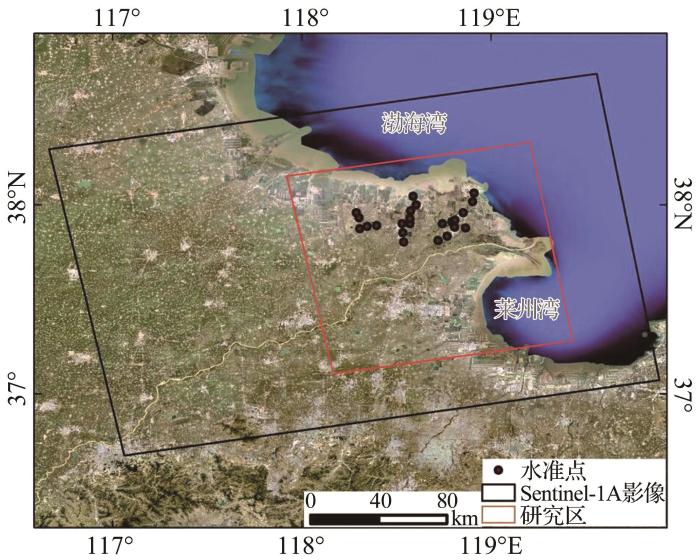
In the context of global climate change, rising sea levels and ground subsidence are putting the Yellow River Delta at serious risk of seawater inundation, posing a threat to the future sustainable development of the Yellow River Delta. Projecting the relative sea level change in the Yellow River Delta due to ground subsidence can help to gain insight into the current seawater inundation risk and take timely measures to address it. First, the average subsidence rate from February 2016 to September 2019 was obtained based on SBAS-InSAR technology, and the accuracy of the InSAR results was further improved by using level data, with the maximum average subsidence rate reaching -357 mm/a after compensation. Combined with high-resolution imagery, it was found that the main cause of ground subsidence is the extraction of underground brine, oil, and gas. Second, combined with the distribution of subsidence sites, it was found that natural sedimentation continued to influence coastal subsidence. Finally, a seawater inundation model was developed using an active algorithm that combines the results of surface subsidence with confidence intervals for sea level rise under the SSP2-4.5 scenario in the IPCC AR6. The model results show that by 2030, 2050, and 2100, the percentage of seawater inundation area will be 6.76%~6.84%, 10.81%~11.11%, and 28.71%~30.92%, respectively, at the current subsidence rate. When the subsidence rate decreases to 50% and 25% of the current rate, the percentage of seawater inundation area is 5.84%~5.91%, 8.20%~8.40%, and 19.05%~21.51%, and 5.34%, 6.60%~6.69%, and 9.89%~11.62%, respectively. Compared to the threat of absolute sea level rise, the containment of subsidence rates will substantially reduce the risk of seawater inundation. The main types of land inundated by seawater are construction land, arable land, water bodies, and salt flats. The rate of seawater inundation of construction land, arable land, and water bodies will continue to accelerate over time. The results of this study can be used as a reference by relevant authorities to manage the development of soil and water resources as well as for disaster prevention in the Yellow River Delta.
Key words: Yellow River Delta; Land subsidence; SBAS-InSAR; Sea level rise; Seawater inundation
Rongrong NING , De WANG , Xinpeng TIAN , Yongwei ZHANG , Zixiang ZHOU , Fubin LUO . Analysis of Ground Settlement in the Yellow River Delta and Projection of Seawater Inundation[J]. Advances in Earth Science, 2023 , 38(3) : 296 -308 . DOI: 10.11867/j.issn.1001-8166.2023.006
| 1 | QIN Tongchun, CHENG Guoming, WANG Haigang. The latest progress of research on land subsidence abroad and its inspiration to China[J]. Geological Bulletin of China, 2018, 37(): 503-509. |
| 1 | 秦同春, 程国明, 王海刚. 国际地面沉降研究进展的启示[J]. 地质通报, 2018, 37(): 503-509. |
| 2 | LIU Y L, LIU J Q, XIA X F, et al. Land subsidence of the Yellow River Delta in China driven by river sediment compaction[J]. Science of the Total Environment, 2021, 750. DOI:10.1016/j.scitotenv.2020.142165 . |
| 3 | CAVALIé O, SLADEN A, KELNER M. Detailed quantification of delta subsidence, compaction and interaction with man-made structures: the case of the NCA airport, France[J]. Natural Hazards and Earth System Sciences, 2015, 15(9): 1 973-1 984. |
| 4 | HIGGINS S A, OVEREEM I, STECKLER M S, et al. InSAR measurements of compaction and subsidence in the Ganges-Brahmaputra Delta, Bangladesh[J]. Journal of Geophysical Research: Earth Surface, 2014, 119(8): 1 768-1 781. |
| 5 | MEEHL G A, WASHINGTON W M, COLLINS W D, et al. How much more global warming and sea level rise? [J]. Science, 2005, 307(5 716): 1 769-1 772. |
| 6 | ERICSON J P, V?R?SMARTY C J, LAWRENCE D S, et al. Effective sea-level rise and deltas: causes of change and human dimension implications[J]. Global and Planetary Change, 2006, 50(1/2): 63-82. |
| 7 | WANG G Y, LI P, LI Z H, et al. Coastal dam inundation assessment for the Yellow River Delta: measurements, analysis and scenario[J]. Remote Sensing, 2020, 12(21). DOI:10.3390/rs12213658 . |
| 8 | PAOLA C, TWILLEY R R, EDMONDS D A, et al. Natural processes in delta restoration: application to the Mississippi Delta[J]. Annual Review of Marine Science, 2011, 3: 67-91. |
| 9 | XIAO Hongfei, WANG Dong, BIAN Zhigang. Study on the characteristics of sea level change in the Bohai and Yellow Seas based on ERA5 dataset[J]. Transactions of Oceanology and Limnology, 2020(5): 9-15. |
| 9 | 肖鸿飞, 王冬, 边志刚. 基于ERA5数据集的黄渤海海平面变化特征研究[J]. 海洋湖沼通报, 2020(5): 9-15. |
| 10 | YU Yifa. Advance of the researches on the variations of Mean-Sea-Level (MSL) in the coastal waters of China[J]. Journal of Ocean University of Qingdao, 2004, 34(5): 713-719. |
| 10 | 于宜法. 中国近海海平面变化研究进展[J]. 中国海洋大学学报(自然科学版), 2004, 34(5): 713-719. |
| 11 | ZHANG Jie. Sea level change in coastal China Seas during the 21st based on SSPs scenarios[D]. Zhoushan: Zhejiang Ocean University, 2022. |
| 11 | 张洁. 基于SSPs情景下21世纪中国近海海平面变化[D]. 舟山: 浙江海洋大学, 2022. |
| 12 | HU Zhibo, GUO Jinyun, TAN Zhengguang, et al. Sea level variation in Hong Kong determined with TOPEX/Poseidon and tide gauge[J]. Journal of Geodesy and Geodynamics, 2014, 34(4): 56-59. |
| 12 | 胡志博, 郭金运, 谭争光, 等. 由TOPEX/Poseidon和验潮站监测香港海平面变化[J]. 大地测量与地球动力学, 2014, 34(4): 56-59. |
| 13 | MU D P, XU T H, XU G C. Detecting coastal ocean mass variations with GRACE mascons[J]. Geophysical Journal International, 2019, 217(3): 2 071-2 080. |
| 14 | XU Tianhe, YANG Yuanyuan, MU Dapeng, et al. Causes of coastal sea level change[J]. Geomatics and Information Science of Wuhan University, 2022, 47(10): 1 750-1 757. |
| 14 | 徐天河, 杨元元, 穆大鹏, 等. 近海海平面变化成因分析[J]. 武汉大学学报(信息科学版), 2022, 47(10): 1 750-1 757. |
| 15 | XU Tianhe, MU Dapeng, YAN Haoming, et al. The causes of contemporary sea level rise over recent two decades:progress and challenge[J]. Acta Geodaetica et Cartographica Sinica, 2022, 51(7):1 294-1 305. |
| 15 | 徐天河, 穆大鹏, 闫昊明, 等. 近 20 年海平面变化成因研究进展及挑战 [J].测绘学报, 51(7): 1 294-1 305. |
| 16 | ZHANG Tong, YU Yongqiang, XIAO Cunde, et al. Interpretation of IPCC AR6 report: monitoring and projections of global and regional sea level change[J]. Climate Change Research, 2022, 18 (1): 12-18. |
| 16 | 张通, 俞永强, 效存德, 等. IPCC AR6解读:全球和区域海平面变化的监测和预估[J]. 气候变化研究进展, 2022, 18 (1): 12-18. |
| 17 | de WIT K, LEXMOND B R, STOUTHAMER E, et al. Identifying causes of urban differential subsidence in the Vietnamese Mekong delta by combining InSAR and field observations[J]. Remote Sensing, 2021, 13(2). DOI:10.3390/rs13020189 . |
| 18 | XU B, FENG G C, LI Z W, et al. Coastal subsidence monitoring associated with land reclamation using the point target based SBAS-InSAR method: a case study of Shenzhen, China[J]. Remote Sensing, 2016, 8(8). DOI:10.3390/rs8080652 . |
| 19 | ERBAN L E, GORELICK S M, ZEBKER H A. Groundwater extraction, land subsidence, and sea-level rise in the Mekong Delta, Vietnam[J]. Environmental Research Letters, 2014, 9(8). DOI:10.1088/1748-9326/9/8/084010 . |
| 20 | HIGGINS S A. Review: advances in delta-subsidence research using satellite methods[J]. Hydrogeology Journal, 2016, 24(3): 587-600. |
| 21 | HUSSAIN M A, CHEN Z L, SHOAIB M, et al. Sentinel-1A for monitoring land subsidence of coastal city of Pakistan using Persistent Scatterers In-SAR technique[J]. Scientific Reports, 2022, 12. DOI:10.1038/s41598-022-09359-7 . |
| 22 | GEBREMICHAEL E, SULTAN M, BECKER R, et al. Assessing land deformation and sea encroachment in the Nile delta: a radar interferometric and inundation modeling approach[J]. Journal of Geophysical Research: Solid Earth, 2018, 123(4): 3 208-3 224. |
| 23 | YAO Wenyi, GAO Yajun, ZHANG Xiaohua. Relationship evolution between runoff and sediment transport in the Yellow River and related scientific issues[J]. Science of Soil and Water Conservation, 2020, 18(4): 1-11. |
| 23 | 姚文艺, 高亚军, 张晓华. 黄河径流与输沙关系演变及其相关科学问题[J]. 中国水土保持科学, 2020, 18(4): 1-11. |
| 24 | CHENG Xia, ZHANG Yonghong, DENG Min, et al. Analysis of recent surface deformation of the Yellow River Delta based on Sentinel-1A satellite[J]. Science of Surveying and Mapping, 2020, 45(2): 43-51. |
| 24 | 程霞, 张永红, 邓敏, 等. Sentinel-1A卫星的黄河三角洲近期地表形变分析[J]. 测绘科学, 2020, 45(2): 43-51. |
| 25 | WANG H J, WU X, BI N S, et al. Impacts of the dam-orientated water-sediment regulation scheme on the lower reaches and delta of the Yellow River (Huanghe): a review[J]. Global and Planetary Change, 2017, 157: 93-113. |
| 26 | WANG S, FU B J, PIAO S L, et al. Reduced sediment transport in the Yellow River due to anthropogenic changes[J]. Nature Geoscience, 2016, 9(1): 38-41. |
| 27 | LIU Y, HUANG H J. Characterization and mechanism of regional land subsidence in the Yellow River Delta, China[J]. Natural Hazards, 2013, 68(2): 687-709. |
| 28 | ZHANG Y, LIU Y L, ZHANG X Y, et al. Correlation analysis between land-use/cover change and coastal subsidence in the Yellow River Delta, China: reviewing the past and prospecting the future[J]. Remote Sensing, 2021, 13(22). DOI:10.3390/rs13224563 . |
| 29 | WANG S Y, ZHANG G, CHEN Z W, et al. Surface deformation extraction from small baseline subset synthetic aperture radar interferometry (SBAS-InSAR) using coherence-optimized baseline combinations[J]. GIScience & Remote Sensing, 2022, 59(1): 295-309. |
| 30 | BERARDINO P, FORNARO G, LANARI R, et al. A new algorithm for surface deformation monitoring based on small baseline differential SAR interferograms[J]. IEEE Transactions on Geoscience and Remote Sensing, 2002, 40(11): 2 375-2 383. |
| 31 | ZHAO Xiuying, WANG Yaoqiang, LI Hongyu, et al. Design and implementation of seed spread algorithm for calculations of source flood submerge area based on DEM[J]. Science & Technology Review, 2012, 30(8): 61-64. |
| 31 | 赵秀英, 王耀强, 李洪玉, 等. 基于DEM的有源淹没算法设计与实现: 以种子蔓延法为例[J]. 科技导报, 2012, 30(8): 61-64. |
| 32 | FOX-KEMPER B, HEWITT H T, XIAO C, et al. Ocean, cryosphere and sea level change [M]// IPCC. Climate change 2021: the physical science basis. Cambridge: Cambridge University Press, 2021. |
| 33 | YANG Jie, HUANG Xin. The 30?m annual land cover and its dynamics in China from 1990 to 2019[J]. Earth System Science Data, 2021, 13: 3 907-3 925. |
| 34 | GE Daqing. Research on key technology of InSAR monitoring of regional land subsidence[D]. Beijing: China University of Geosciences (Beijing), 2013. |
| 34 | 葛大庆. 区域性地面沉降InSAR监测关键技术研究[D]. 北京: 中国地质大学(北京), 2013. |
| 35 | HOU Zhandong. Comparison and analysis of the spatial interpolation methods of the urban ground subsidence monitoring data[J]. Geospatial Information, 2020, 18(8): 106-109. |
| 35 | 侯占东. 城市地面沉降监测数据的插值方法对比分析[J]. 地理空间信息, 2020, 18(8): 106-109. |
| 36 | DAWSON R, HALL J, SAYERS P, et al. Sampling-based flood risk analysis for fluvial dike systems[J]. Stochastic Environmental Research and Risk Assessment, 2005, 19(6): 388-402. |
| 37 | LIU Xiaoshuai, TAO Qiuxiang, NIU Chong, et al. Comparative analysis and verification of DInSAR and SBAS InSAR in mining subsidence monitoring[J]. Progress in Geophysics, 2022, 37(5): 1 825-1 833. |
| 37 | 刘晓帅, 陶秋香, 牛冲, 等. DInSAR与SBAS InSAR矿区地面沉降监测能力对比分析与验证[J]. 地球物理学进展, 2022, 37(5): 1 825-1 833. |
| 38 | ZHANG Yi. Spatial-temporal variations and distribution characteristics in subsidence due to the natural consolidation and compaction of sediment in the Yellow River Delta, China[D]. Qingdao: Institute of Oceanology, Chinese Academy of Sciences, 2018. |
| 38 | 张翼. 黄河三角洲浅层沉积物固结压实的时空变化及分布特征[D]. 青岛:中国科学院海洋研究所, 2018. |
| 39 | HIGGINS S, OVEREEM I, TANAKA A, et al. Land subsidence at aquaculture facilities in the Yellow River Delta, China[J]. Geophysical Research Letters, 2013, 40(15): 3 898-3 902. |
| 40 | HERRERA-GARCíA G, EZQUERRO P, TOMáS R, et al. Mapping the global threat of land subsidence[J]. Science, 2021, 371(6 524): 34-36. |
| 41 | WANG H J, BI N S, SAITO Y, et al. Recent changes in sediment delivery by the Huanghe (Yellow River) to the sea: causes and environmental implications in its estuary[J]. Journal of Hydrology, 2010, 391(3/4): 302-313. |
/
| 〈 |
|
〉 |
