青藏高原—沙漠的陆—气耦合及对干旱影响的进展及其关键科学问题
李耀辉1,2( ), 孟宪红3, 张宏升4, 李忆平2, 王闪闪5, 沙莎2, 莫绍青5
), 孟宪红3, 张宏升4, 李忆平2, 王闪闪5, 沙莎2, 莫绍青5
Advances and Key Scientific Issues of Land-Atmosphere Coupling Between the Tibet Plateau and the Northern Desert and Its Impact on Northern China Drought
Yaohui LI1,2(), Xianhong MENG3, Hongsheng ZHANG4, Yiping LI2, Shanshan WANG5, Sha SHA2, Shaoqing MO5
), Xianhong MENG3, Hongsheng ZHANG4, Yiping LI2, Shanshan WANG5, Sha SHA2, Shaoqing MO5
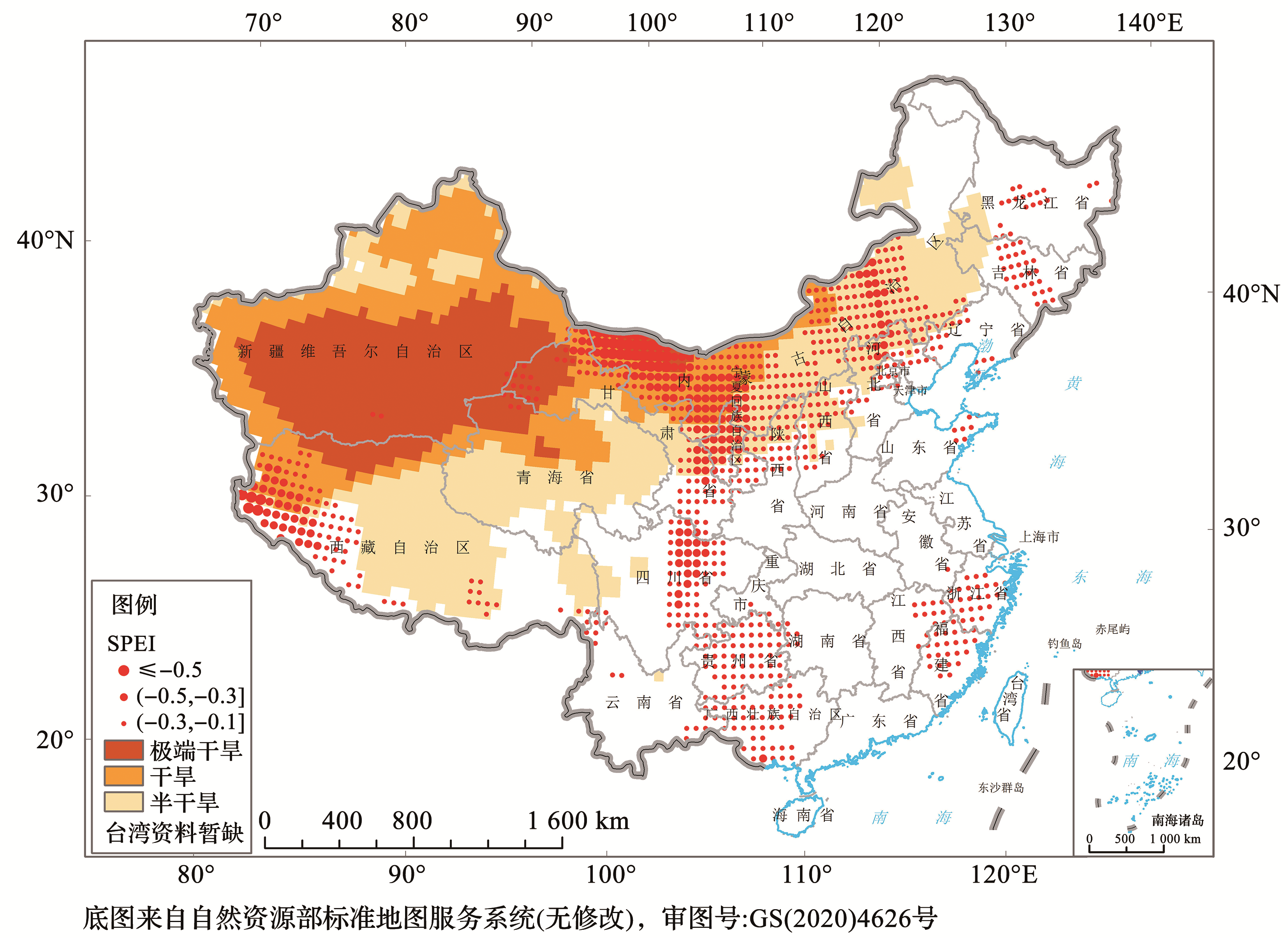
图1. 基于SPEI指数划分的我国干旱半干旱地区和干旱频发区(据参考文献[
圆点表示1981—2010年气候平均小于-0.1的标准化降水蒸发指数SPEI(12),即SPEI(12)<-0.1,反映该地区易发生气象干旱
Fig.1. Arid and semi-arid regions and drought-prone regions based on SPEI index in China(redrawn according to reference [
The dots represent the 12-month standardized precipitation evaporation index SPEI(12)which is less than -0.1 over 30-year climate average from 1981 to 2010,that is,SPEI(12)<-0.1,shows that this region is prone to drought in climate