), 罗万银1(), 邵梅1,2, 王中原3
), Wanyin LUO1(), Mei SHAO1,2, Zhongyuan WANG3
), 罗万银1(), 邵梅1,2, 王中原3
), Wanyin LUO1(), Mei SHAO1,2, Zhongyuan WANG3
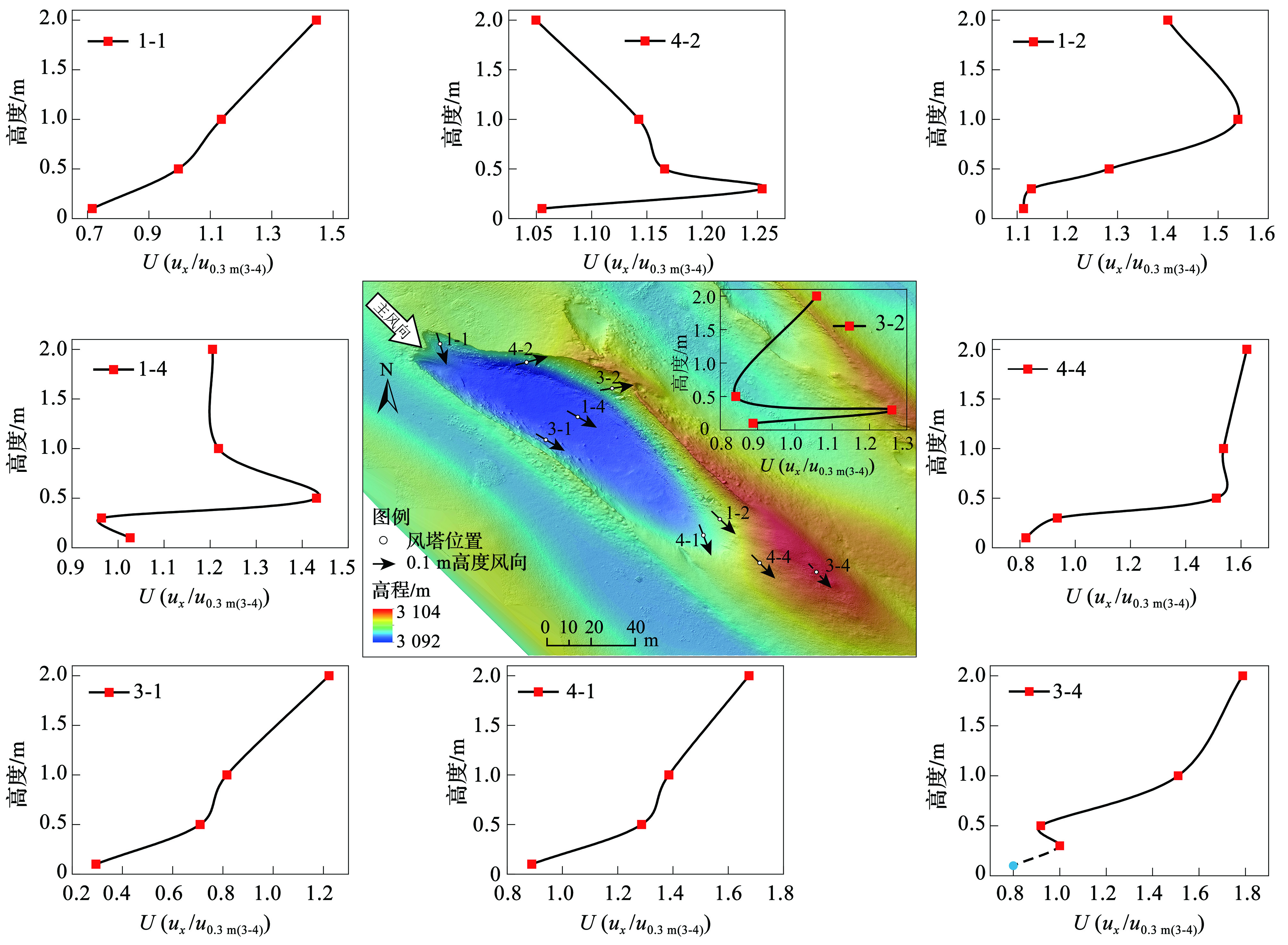
图6. 风蚀坑B4不同部位风速廓线图
图中参考风向为风速廓线观测期间气象站所测,表示进入风蚀坑的初始气流方向;风蚀坑内的箭头表示各观测点距地表0.1 m高度的风向;风速廓线图中表示的是各测点不同高度的相对风速。由于风速仪传感错误,3-4测站0.1 m高度处数据及3-2测站1.0 m高度处数据被剔除,但基于前文中贴地层气流的观测结果,判断3-4测站0.1 m高度的风速应低于积沙体迎风坡测点同高度的风速,U0.1 m(3-4)≈0.8(实心图标表示),风向保持沿积沙体走向发展(虚线箭头表示)
Fig.6. The wind speed profiles at different positions of the trough blowout B4
The reference wind direction in the figure was measured by the meteorological station during the observation, indicated the initial direction of the airflow before entering the wind blowout. The arrow in the blowout indicates the wind direction at 0.1 m height from the surface of each observation point. The wind speed profile shows the wind speed at different heights of each observation point. Because of the anemometer sensor error, wind speed and the direction at 0.1 m height of station 3-4 and 1.0 m height of station 3-2 were eliminated. Based on the observation results of the near surface airflow above, we believe that wind speed at 0.1 m height of station 3-4 should be lower than the windward side of the deposition, U0.1 m (3-4)≈0.8 (the solid circle), wind direction should be along with the deposition (the dotted arrow)