南海碳源汇的区域与季节变化特征及控制因素研究进展
Advances in Seasonal Variations and Controls of the Air-sea CO2 Flux in the South China Sea
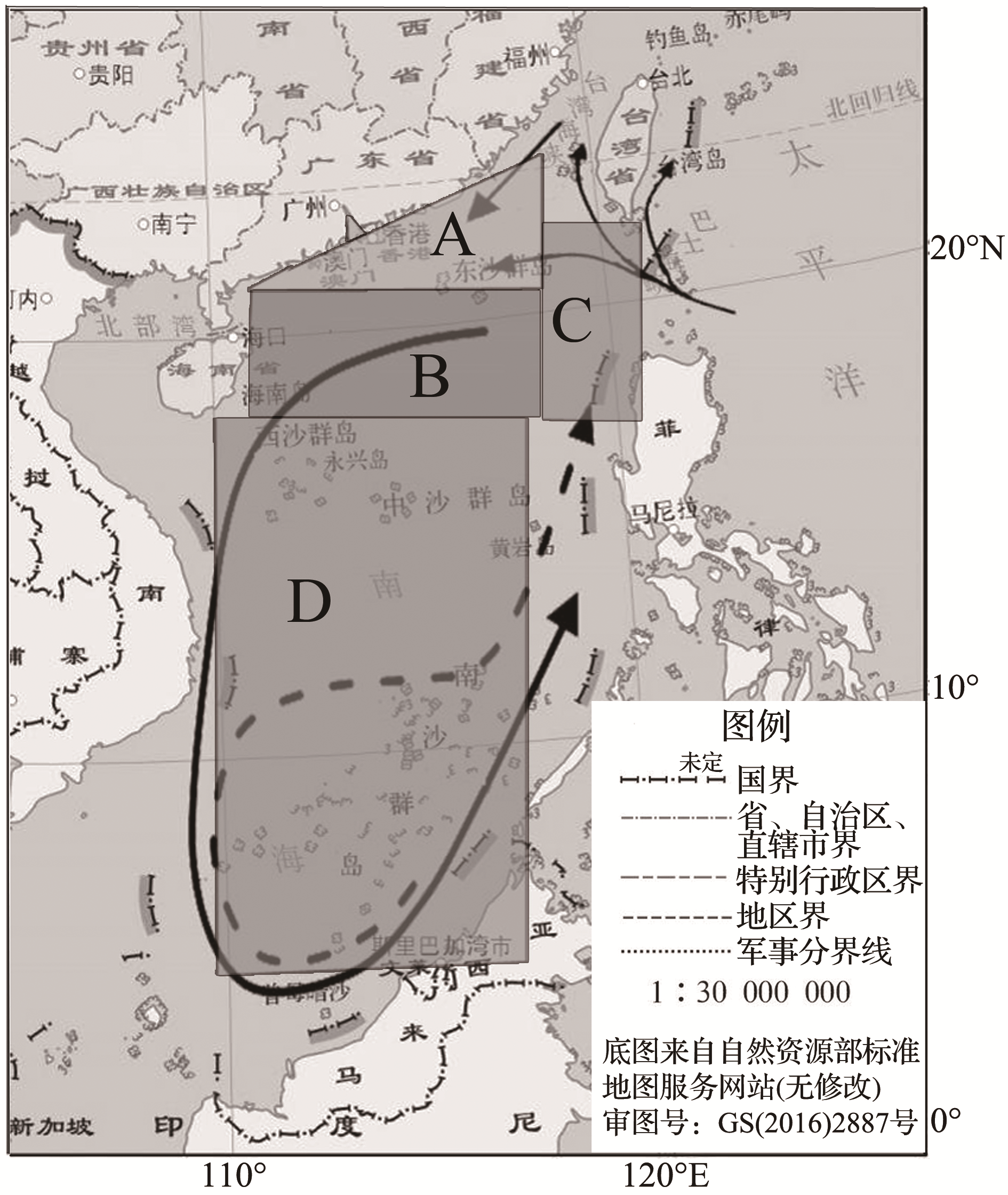
根据南海的物理—生物地球化学特征,将南海划分为:A.南海北部陆架,B.南海北部陆坡及海盆,C.吕宋海峡西侧海域,D.南海中南部海盆;南海实体曲线代表冬季整个流域的气旋环流,虚线代表夏季反气旋环流,吕宋海峡周围的实体曲线代表黑潮及其入侵进入南海北部[
Framed areas indicate four physical-biogeochemical domains in the South China Sea:A. The northern shelf in the South China Sea,B. The northern basin and slope in the south China sea, C. The west of the Luzon Strait, D. The central and southern basin in the South China Sea. Solid curves in the South China Sea represent the basin-wide cyclonic gyre in winter, dashed curve in the South China Sea represents the anticyclonic gyre over the southern half of the sea during the summer, and solid curves around the Luzon Strait into the northern South China Sea represent the Kuroshio and its intrusions[