海洋中尺度涡旋表面特征和三维结构研究进展
The Surface and Three-dimensional Characteristics of Mesoscale Eddies: A Review
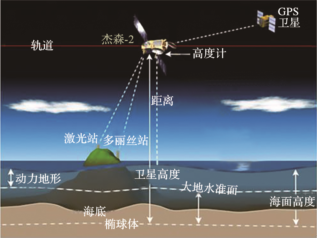
卫星利用雷达高度计向海面发射微波信号,并通过接受反射信号测量海表面高度,海面高度(Sea Surface Height,SSH)为海表面距离地球椭球体的距离,动力地形(Dynamic Topography,DT)为海表面距离大地水准面(Geoid)距离,海表面高度异常(Sea Level Anomaly,SLA或Sea Surface Height Anomaly,SSHA)可表示为SLA(SSHA)=SSH-MSSH=DT-Geoid=SLA-MDT-Geoid,其中MSSH为平均海表面高度,MDT为平均动力地形
The satellite uses a radar altimeter through radiating microwave signals to the sea surface and measure the Sea Surface Height (SSH) by receiving the reflected signals. SSH is the distance from the sea surface to the Earth ellipsoid, Dynamic Topography (DT) is the distance from the sea surface to the geoid, Sea Level Anomaly(SLA) or SSH Anomaly (SSHA) can be expressed as SLA (SSHA) = SSH-MSSH = DT-Geoid = SLA-MDT-Geoid, where MSSH is the average SSH and MDT is the average DT