岩石圈三维结构模型综合与可视化——以青藏高原东缘为例
Data Assimilation and Three-dimensional Visualization of Lithospheric Structures of the Eastern Margin of the Tibetan Plateau
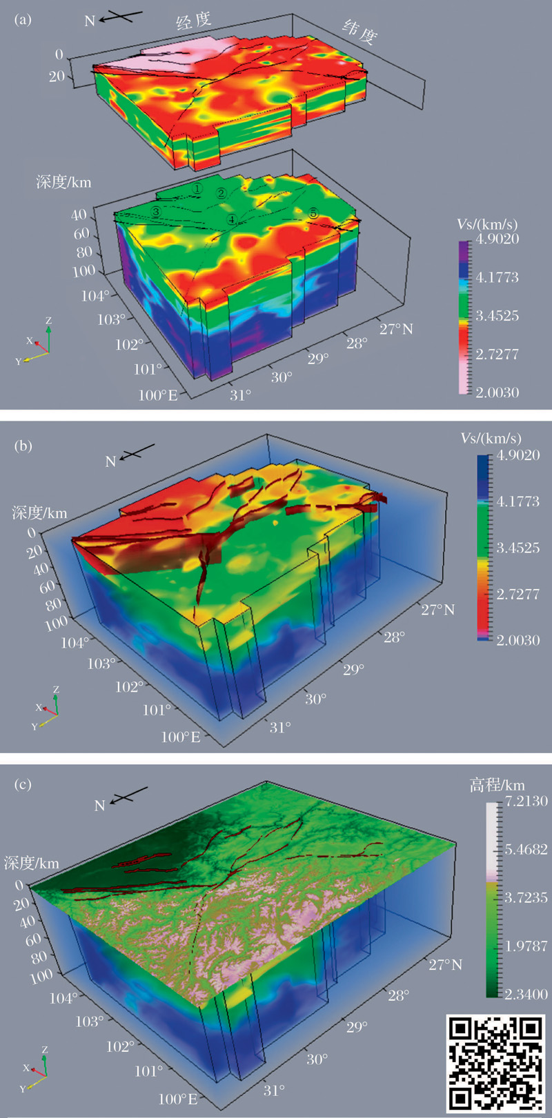
(a) S-wave velocity distribution display in Paraview, rendering function is not used; (b) S-wave velocity structure overlapped with the shallow fault data, rendering function makes the distribution of velocity anomalies visible; (c) S-wave velocity structure overlapped with the shallow faults and surface elevation. Faults are labeled as: ①Longquanshan Fault, ②Yingjing-Mabian Fault, ③Longmenshan Fault, ④Xianshuihe-Xiaojiang Fault, ⑤Xiaojinhe Fault