累积海冰密集度及其在认识北极海冰快速变化的作用
 , 赵进平
, 赵进平 Accumulation Sea Ice Concentration and Its Action on Understanding Arctic Sea Ice Dramatic Change
Wang Weibo, Zhao Jinping
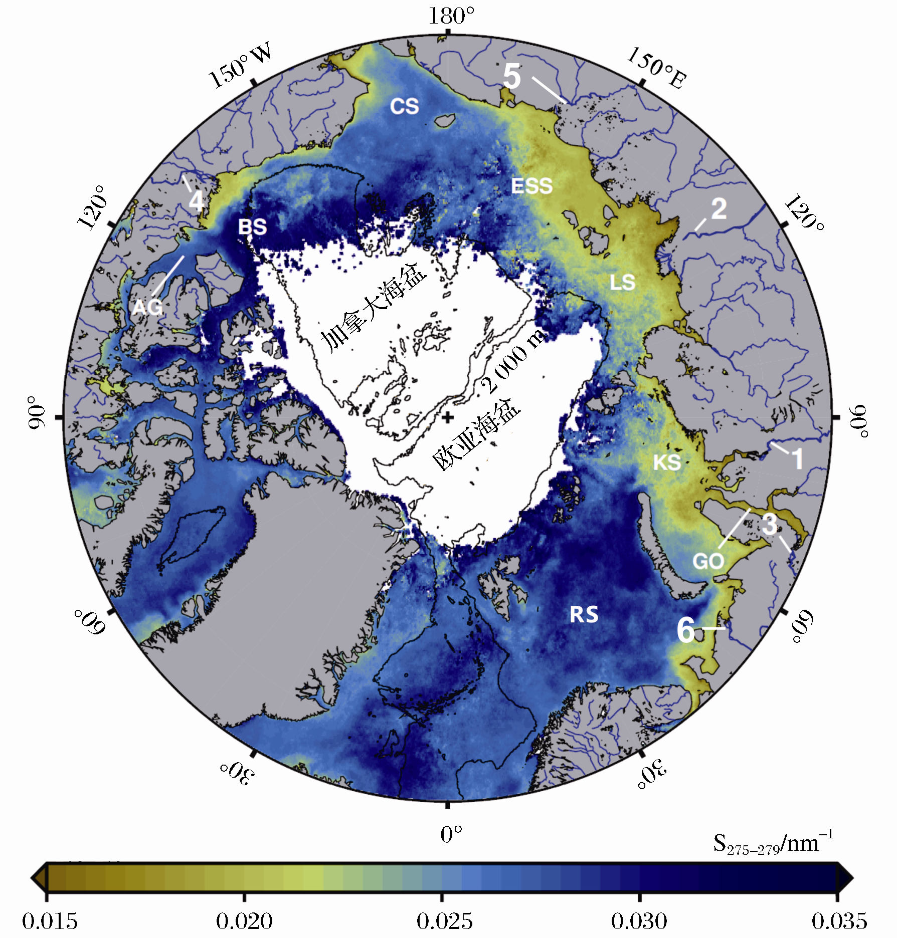
, Zhao Jinping Fig. 9 A pan-Arctic view of an August climatology 2002-2009 of [ 17 ] In increase in corresponds to a diminishing influence of continental runoff. The five largest Arctic Rivers are labels and ranked in order of decreasing discharge: Yenisei 1, Lena 2, Ob 3, Mackenzie 4, Kolyma 5, and Pechora 6. River-influenced margins of the Arctic are labels: Gulf of Ob GO, Kara Sea KS, Laptev Sea LS, East Siberian Sea ESS, Chukchi Sea CS, Beaufort Sea BS, Amundsen Gulf AG and Barents Sea RS