青藏高原水文模拟的现状及未来
 , 李秀萍, 周璟, 刘文彬, 阳坤
 Hydrological modelling over the Tibetan Plateau: Current status and Perspective
Wang Lei, Li Xiuping, Zhou Jing, Liu Wenbin, Yang Kun
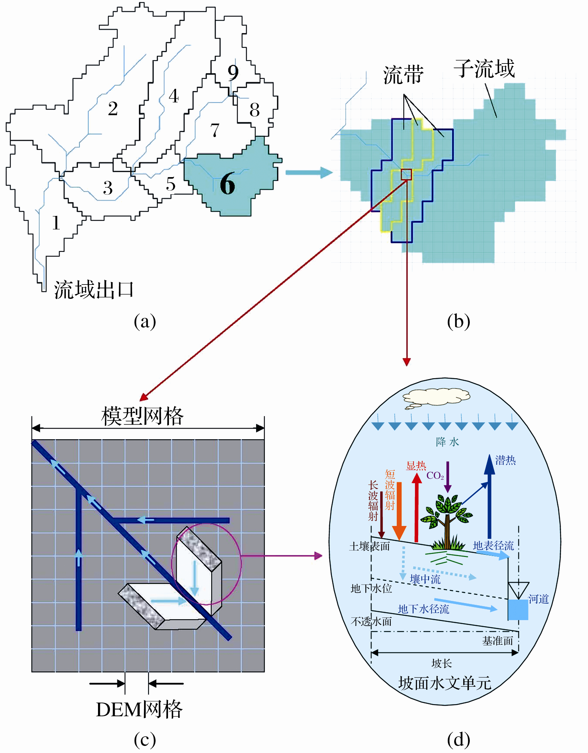
, Li Xiuping, Zhou Jing, Liu Wenbin, Yang Kun Fig.1 Overall structure of multi-sphere hydrological model WEB-DHM aDivision of sub-basins;bFurther division of a sub-basin into several flow intervals following the concept of equal stream lines;cFor each model grid, slope length and slope angle are calculated with the sub-grid parameterization;dFor each model grid, the exchanges of water, energy, CO 2 between land and atmosphere are calculated, and thus get the vertical soil moisture profiles as well as the interceptions by canopy and ground. Finally, hillslope runoff including surface runoff, subsurface flow, and groundwater runoff is calculated using the sub-grid scheme. Here, the runoff of a flow interval is the total runoff of all model grids within the specified flow interval. Finally, the river routing is carried out for all the flow intervals within the whole basin