中国1956—2006年地表土壤冻结天数时空分布及其变化特征
 , 张廷军
, 张廷军 Spatial and Temporal Distribution and Variations in the Near-surface Soil Freezing Days across China, 1956-2006
Wang Kang1 , Zhang Tingjun1, 2, *
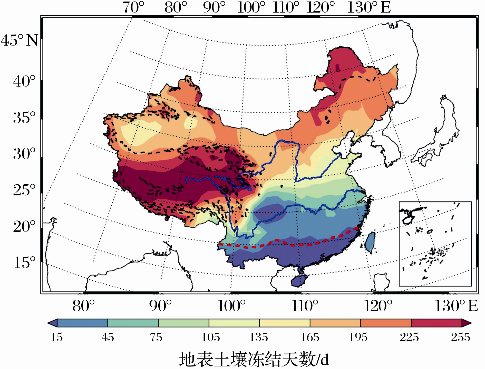
, Zhang Tingjun Fig.6 Ralationship between climatology 1971-2000 of freezing days and map of frozen ground distribution over China Background color represents the contour values of the departure of near-surface soil freezing days from the 1971-2000 mean; Black dashed line is the boundary of permafrost regions, red dashed line is the boundary between frozen and unfrozen ground regions in China