

简缩极化GNSS-ReSAR陆面遥感技术研究
收稿日期: 2025-06-30
修回日期: 2025-08-28
网络出版日期: 2025-10-31
基金资助
国家重点研发计划项目(2024YFB3910001);国家自然科学基金项目(42061057)
Simplified Polarized GNSS-ReSAR Land Surface Remote Sensing Technology
Received date: 2025-06-30
Revised date: 2025-08-28
Online published: 2025-10-31
Supported by
the National Key Research and Development Program of China(2024YFB3910001);The National Natural Science Foundation of China(42061057)
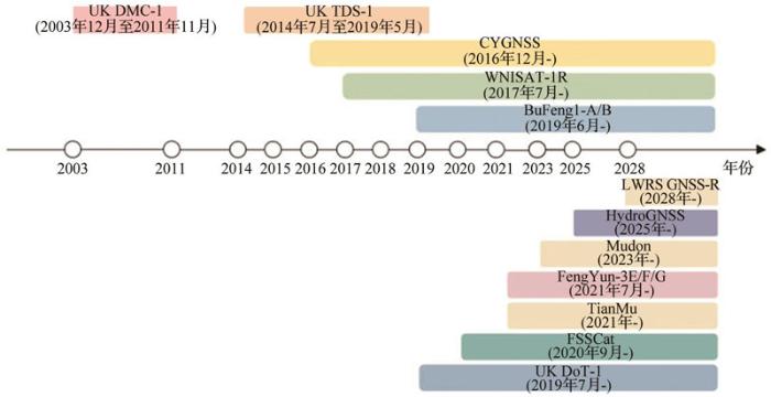
全球导航卫星系统反射测量技术是一种通过解析导航卫星反射信号实现地表参数反演的有效对地观测手段。已有研究表明,传统全球导航卫星系统反射测量技术系统主要采用单一极化配置(右旋圆极化发射与左旋圆极化接收,简称LR极化),对其他极化组合的散射特性研究相对薄弱。随着技术进步,采用右旋圆极化天线接收地表反射信号的方案逐渐受到重视。同时,传统全球导航卫星系统反射测量技术的时延—多普勒图处理模式在不同观测几何条件下对散射特征的利用效率较低。在此背景下,发展能够跨几何构型有效接收地表散射信号的全球导航卫星系统合成孔径雷达(GNSS-SAR)技术成为具有潜力的研究方向。通过聚焦简缩极化全球导航卫星系统反射测量技术与合成孔径雷达融合技术的遥感探索,基于西班牙机载全球导航卫星系统反射计(GLORI)实验获取的双极化[RR(右旋圆极化发射与右旋圆极化接收)]数据开展了土壤水分反演研究,并同步利用中国天目商业卫星的双极化全球导航卫星系统反射测量技术数据进行对比验证。实验表明,RR极化反射率较LR极化低约10 dB,但基于两种极化反演的土壤水分精度具有可比性。受限于简缩极化数据获取能力,采用基于辐射传输理论构建的LAGRS模型解析简缩极化的其他散射特性。通过系统分析合成孔径雷达融合技术模式的散射机制与发展趋势,在一定程度上为新一代全球导航卫星系统反射测量技术技术演进提供了理论参考。
关键词: 全球导航卫星系统反射测量技术; 简缩极化; 时延—多普勒图; 合成孔径雷达
吴学睿 . 简缩极化GNSS-ReSAR陆面遥感技术研究[J]. 地球科学进展, 2025 , 40(9) : 902 -915 . DOI: 10.11867/j.issn.1001-8166.2025.078
Global Navigation Satellite System Reflectometry (GNSS-R) is an effective Earth observation method that analyzes navigation satellite reflection signals to invert surface parameters. Historical research has shown that traditional GNSS-R systems primarily adopt a single-polarization configuration (Right-Handed Circularly Polarized (RHCP) transmission and Left-Handed Circularly Polarized (LHCP) reception, hereinafter referred to as LR polarization). With the advancement of technology, the use of RHCP antennas to receive surface-reflected signals has gained attention. The traditional Delay-Doppler Map (DDM) processing mode of GNSS-R has low efficiency in utilizing scattering features under different observation geometries. In this context, the development of GNSS-based Synthetic Aperture Radar (GNSS-SAR) technology that can effectively receive surface scattering signals across geometric configurations has become a promising research direction. This study focuses on remote sensing exploration of the fusion technology of reduced polarization GNSS-R and synthetic aperture radar (GNSS ReSAR: GNSS Reflectometry and Synthetic Aperture Radar). Based on dual-polarization (LR and RR) data obtained from the Spanish airborne GLORI experiment, soil moisture inversion research was conducted. Dual-polarization GNSS-R data from the Chinese Tianmu (TM) commercial satellite were synchronously used for comparative verification. Both experiments consistently showed that the reflectance of the RR polarization was approximately 10 dB lower than that of the LR polarization, but the accuracy of soil moisture inversion based on the two polarizations was comparable. Because of the limited ability to obtain simplified polarization data, this study used the Land Surface GNSS Reflection Simulator (LAGRS) model, constructed based on radiative transfer theory, to analyze other scattering characteristics of simplified polarization. A systematic analysis of the scattering mechanism and development trend of the GNSS ReSAR mode provides a theoretical reference for the evolution of new-generation GNSS-R technology to a certain extent.
| [1] | HALL C D, CORDEY R A. Multistatic scatterometry[C]// International geoscience and remote sensing symposium, ‘Remote sensing: moving toward the 21st century’. Edinburgh, UK: IEEE, 1988. DOI:10.1109/igarss.1988.570200 . |
| [2] | MARTIN-NEIRA M. A Passive Reflectometry and Interferometry System (PARIS): application to ocean altimetry[J]. ESA Journal, 1993, 17(4): 331-335. |
| [3] | LIU Jingnan, SHAO Lianjun, ZHANG Xunxie, et al. Advances in GNSS-R studies and key technologies[J]. Geomatics and Information Science of Wuhan University,2007, 32(11): 955-960. |
| 刘经南,邵连军,张训械,等. GNSS-R研究进展及其关键技术[J]. 武汉大学学报(信息科学版), 2007, 32(11):955-960. | |
| [4] | SMEX 02 experiment plan, USDA, 2002 [Z/OL]. [2025-05-25]. . |
| [5] | ZAVOROTNY V U, MASTERS D, GASIEWSKI A J, et al. Seasonal polarimetric measurements of soil moisture using tower-based GPS bistatic radar[C]// 2003 IEEE international geoscience and remote sensing symposium. Proceedings. Toulouse, France: IEEE, 2003, 2: 781-783. |
| [6] | RODRIGUEZ-ALVAREZ N, CAMPS A, VALL-LLOSSERA M, et al. Land geophysical parameters retrieval using the interference pattern GNSS-R technique[J]. IEEE Transactions on Geoscience and Remote Sensing, 2011, 49(1): 71-84. |
| [7] | MOTTE E, ZRIBI M, FANISE P, et al. GLORI: a GNSS-R dual polarization airborne instrument for land surface monitoring[J]. Sensors, 2016, 16(5): 732. DOI:10.3390/s16050732 . |
| [8] | CARRENO-LUENGO H, RUF C S, GLEASON S, et al. Latest progress on rongowai polarimetric GNSS-R airborne mission[C]// IGARSS 2024-2024 IEEE international geoscience and remote sensing symposium. Athens, Greece: IEEE, 2024. DOI:10.1109/igarss53475.2024.10642216 . |
| [9] | EGIDO A, PALOSCIA S, MOTTE E, et al. Airborne GNSS-R polarimetric measurements for soil moisture and above-ground biomass estimation[J]. IEEE Journal of Selected Topics in Applied Earth Observations and Remote Sensing, 2014, 7(5): 1 522-1 532. |
| [10] | GLEASON S, UNWIN M. Sensing ocean, ice and land reflected signals from space: results from the UK-DMC GPS reflectometry experiment[C]// ION GNSS. Long Beach, CA, 2005: 1 679-1 685. |
| [11] | UNWIN M, JALES P, TYE J, et al. Spaceborne GNSS-reflectometry on TechDemoSat-1: early mission operations and exploitation[J]. IEEE Journal of Selected Topics in Applied Earth Observations and Remote Sensing, 2016, 9(10): 4 525-4 539. |
| [12] | RUF C S, ATLAS R, CHANG P S, et al. New ocean winds satellite mission to probe hurricanes and tropical convection[J]. Bulletin of the American Meteorological Society, 2016, 97(3): 385-395. |
| [13] | UNWIN M J, PIERDICCA N, CARDELLACH E, et al. An introduction to the HydroGNSS GNSS reflectometry remote sensing mission[J]. IEEE Journal of Selected Topics in Applied Earth Observations and Remote Sensing, 2021, 14: 6 987-6 999. |
| [14] | ZHAO T J, SHI J C, LV L Q, et al. Soil moisture experiment in the Luan River supporting new satellite mission opportunities[J]. Remote Sensing of Environment, 2020, 240. DOI:10.1016/j.rse.2020.111680 . |
| [15] | RODRIGUEZ-ALVAREZ N, MISRA S, MORRIS M. Sensitivity analysis of smap-reflectometry (SMAP-R) signals to vegetation water content[C]// IGARSS 2019-2019 IEEE international geoscience and remote sensing symposium. Yokohama, Japan: IEEE, 2019: 7 395-7 398. |
| [16] | PIERDICCA N, GUERRIERO L, GIUSTO R, et al. SAVERS: a simulator of GNSS reflections from bare and vegetated soils[J]. IEEE Transactions on Geoscience and Remote Sensing, 2014, 52(10): 6 542-6 554. |
| [17] | KURUM M, DESHPANDE M, JOSEPH A T, et al. SCoBi-veg: a generalized bistatic scattering model of reflectometry from vegetation for signals of opportunity applications[J]. IEEE Transactions on Geoscience and Remote Sensing, 2019, 57(2): 1 049-1 068. |
| [18] | WU X R, WANG F. LAGRS-Veg: a spaceborne vegetation simulator for full polarization GNSS-reflectometry[J]. GPS Solutions, 2023, 27(3). DOI: 10.1007/s10291-023-01441-5 . |
| [19] | WU X R, OUYANG X Q, XIA J M, et al. LAGRS-soil: a full-polarization GNSS-reflectometry model for bare soil applications in FY-3E GNOS-R payload[J]. Remote Sensing, 2023, 15(22). DOI: 10.3390/rs15225296 . |
| [20] | WU X R, JIN S G, OUYANG X Q. A full-polarization GNSS-R Delay-Doppler-Map (DDM) simulator for bare soil freeze/thaw process detection[J]. Geoscience Letters, 2020, 7(1). DOI: 10.1186/s40562-020-00154-8 . |
| [21] | YANG G L, DU X Y, HUANG L Y, et al. An illustration of FY-3E GNOS-R for global soil moisture monitoring[J]. Sensors, 2023, 23(13). DOI: 10.3390/s23/35825 . |
| [22] | WU X R, CHEN L X, SHI J C. Optimization of random surface scattering models for RR polarization in SoOp-R/GNSS-R applications[J]. IEEE Journal of Selected Topics in Applied Earth Observations and Remote Sensing, 2024, 17: 4 890-4 898. |
| [23] | AL-KHALDI M M, JOHNSON J T, O’BRIEN A J, et al. Time-series retrieval of soil moisture using CYGNSS[J]. IEEE Transactions on Geoscience and Remote Sensing, 2019, 57(7): 4 322-4 331. |
| [24] | CHEW C, SMALL E. Description of the UCAR/CU soil moisture product[J]. Remote Sensing, 2020, 12(10). DOI: 10.3390/rs12101558 . |
| [25] | LI Y, YAN S H, GONG J Y. Target detection and location by fusing delay-Doppler maps[J]. IEEE Transactions on Geoscience and Remote Sensing, 2023, 61: 1-14. |
| [26] | WU X R, SHI J C. Polarization GNSS-reflectometry: potential and possibility[C]// 2021 IEEE specialist meeting on reflectometry using GNSS and other signals of opportunity (GNSS+R). Beijing, China: IEEE, 2021: 29-31. DOI:10.1109/gnssr53802.2021.9617680 . |
| [27] | DASSAS K, FANISE P, Le PAGE M, et al. Polarimetric instrument Global Navigation Satellite System-Reflectometry airborne data[J]. Data in Brief, 2024, 52. DOI: 10.1016/j.dib.2023.109850 . |
| [28] | WU X, HAN S, HUANG X, et al. Soil moisture retrieval using single-frequency dual-polarization GNSS-R data from airborne GLORI experiment[J]. IEEE Journal of Selected Topics in Applied Earth Observations and Remote Sensing, 2025(18):20 655-20 665. |
| [29] | ZAVOROTNY V U, VORONOVICH A G. Scattering of GPS signals from the ocean with wind remote sensing application[J]. IEEE Transactions on Geoscience and Remote Sensing, 2000, 38(2): 951-964. |
| [30] | MUNOZ-MARTIN J F, RODRIGUEZ-ALVAREZ N, BOSCH-LLUIS X, et al. Stokes parameters retrieval and calibration of hybrid compact polarimetric GNSS-R signals[J]. IEEE Transactions on Geoscience and Remote Sensing, 2022, 60: 1-11. |
| [31] | WU Xuerui, XIA Junming, BAI Weihua, et al. Advancing GNOS-R soil moisture estimation: a multi-angle retrieval algorithm for FY-3E[J]. Remote Sensing, 2025, 17(13). DOI: 10.3390/rs17132325 . |
| [32] | ULABY F T, ELACHI C. Radar polarimetry for geoscience applications[M]. Dedham, MA: Artech House, 1990. |
| [33] | WU X R, JIN S G. Models and theoretical analysis of SoOp circular polarization bistatic scattering for random rough surface[J]. Remote Sensing, 2020, 12(9). DOI: 10.3390/rs12091506 . |
/
| 〈 |
|
〉 |
